Contact Us
     18 Town Center Drive, Troy, Michigan 48084         646-368-0082         718-301-8236         info@velitsolution.com   
GIS

VEL IT SOLUTION includes the following services:

Digital Orthophotography:

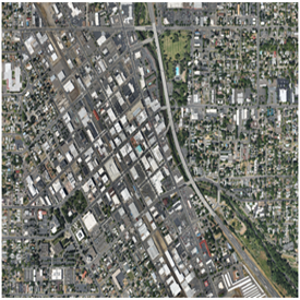
The topographical variations in the surface of the earth and the tilt of the camera affect the distance with which features on the aerial image are displayed. The more topographically diverse the landscape, the more distortion inherent in the photograph. As a result, real world distances are not represented uniformly on the photograph. For example, an inch measured in a steep area would relate to a much longer distance than an inch measured over a flat surface such as a plain.

Orthorectification is the process used to remove relief and tilt displacement. After removal of these distortions, correct ground positions and equilibrate photo units with real life distances can be obtained. Once an aerial photo has been Orthorectified, it is commonly referred to as an OrthoPhoto.
 
Planimetric Mapping:

A map that displays only the x,y locations of features and represents only horizontal distances.

Planimetric Mapping is committed to use the advanced technologys and softwares to better advance our products and service to our clients. Our team of trained photogrammetrists, graphic QC/editing professionals has the education, technical background and experience to create a highly accurate, consistent and well organized photogrammetric product.

 
Aerial Triangulations:

In order to map from a Stereo pair of Photograph some pattern of control points should be available. These could be obtained by Ground methods alone. If the job is bulky in nature the amount of control will also increase proportionally which will result in 

  • Higher cost
  • Increase in time
  • Unwarranted delays in map making

For photogrammetric compilation the control points should be at ideal locations. These requirements cannot be met by using Ground methods, due to various constraints in fieldwork. Thus the possibility of dignifying the network of controls based on a skeleton framework of ground controls using aerial photographs was evolved and the method is widely known as aerial triangulation.

To learn more about VEL IT SOLUTION Data Management Services, please Contact us. We look forward to hearing from you.

WHY VEL IT SOLUTION
  • Develop long-term partnerships with our customers.
  • Consistently meet our customers` expectations with our service and product quality.
  • Continuously improve our best practices to maximizeenvironmental, social and economic sustainability.
  • Embrace change and encourage innovation.
  • Offer our employees a challenging and rewarding workplace that inspires loyalty and success.
  • Seek excellence in everything we do.
  • Respect the environment and communities within which we operate. 


VEL IT SOLUTION

Home About Us Services Careers FAQs Our Clients Contact Us
OUR CLIENTS
CONNECT WITH US


CONTACT US

18 Town Center Drive, Troy, Michigan 48084
Phone: 646-368-0082/718-301-8235
Fax: 718-301-8236
e-Mail: info@velitsolution.com
Website: www.velitsolution.com 

Copyright 2017 @ velitsolution.com.  All rights reserved